What and Why?
There are trips you take to relax, and trips you take to think. Seventeen days through Ecuador, the Galápagos, and Peru turned out to be the second kind. The Andes, the equator, and the South Pacific arrange themselves in a way that keeps prompting questions — about altitude physiology, about how lava becomes habitat, about how a stone wall stays standing for half a millennium without mortar. What follows are the observations that wouldn’t leave me alone.
I. Ecuador: Altitude, Volcanoes, and a Country with Personality
Arriving in Quito
I landed at Mariscal Sucre International in the evening — the airport opened in 2013 about 18 km east of Quito in the Tababela valley, after the old in-city airport became impossible to expand safely. From the Panama-to-Quito leg on Copa, I’m fairly sure I caught the canal from the air: the audacious 1914 cut that shaved roughly 8,000 nautical miles off the New York–San Francisco shipping route.
Quito sits at about 2,850 m (9,350 ft). High enough that arterial O₂ saturation drops a few percent on arrival. I had been expecting some strain on the heart, but the only sign of altitude I noticed was that my resting heart rate was up by about three beats per minute. Which fits the physiology: the early hypoxic response runs through sympathetic tone and chemoreceptor signaling well before erythropoiesis ramps up over the following days. (I carried ibuprofen anyway. The one symptom that did appear, unannounced, was a very strong drowsiness during the drive up to Cotopaxi — hypoxia-induced sleepiness is a known prodrome of mild AMS, sometimes the only one.)
The airport hotel turned out to be unexpectedly good. The breakfast had pan de yuca — small cassava-and-cheese rolls; Manihot esculenta, the same root that becomes tapioca in Brazil.
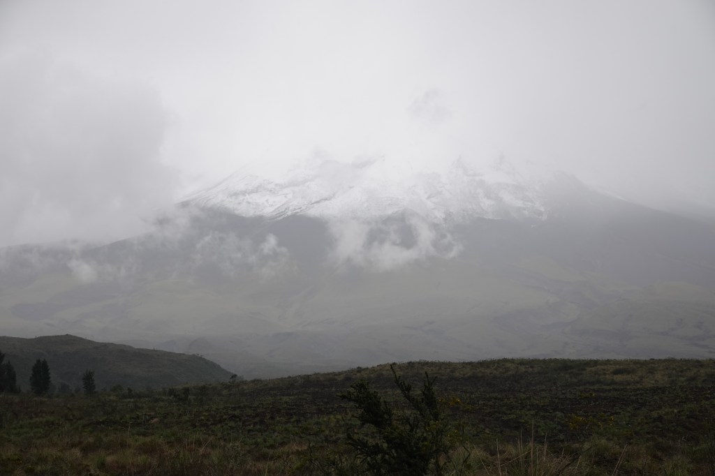
Cotopaxi
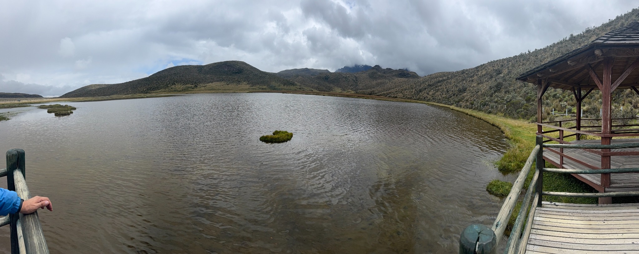
Cotopaxi is one of the world’s tallest active volcanoes: a near-perfect glaciated stratovolcano whose summit reaches 5,897 m (19,347 ft) and which last erupted in 2015. The visitor area is far lower, around 3,400–3,800 m, roughly comparable to Cusco, which made it good practice for the altitudes ahead.
The base camp sits among non-native Pinus radiata, planted in 20th-century reforestation programs. Climb a little and the native páramo takes over — cushion-forming Azorella, bunchgrasses (Calamagrostis, Festuca), the rosette-forming Espeletia relatives. Around Limpiopungo Lake at 12,600 ft, the highest point I would reach on this trip, we found Andean gulls (Chroicocephalus serranus) — the high-altitude inland species, not the misplaced seabirds I first took them for.
Across a gorge near the visitor center, a wire was strung from one side to the other: a tarabita, the hand-pulled cable carrier that Andean communities use to cross ravines where building a bridge is impractical. Engineering by necessity.
Quito’s old town
We (the better half having joined me) returned to Quito proper a week later, after the Galápagos detour. The Virgen del Panecillo — 41 m of aluminum, erected in 1976 — looks out over the northern, wealthier half of the city. The story is that she shows her back to the south, and showing your back in Latin America is considered an insult; one presidential candidate proposed putting her on a revolving pedestal. It never happened. She still faces north.
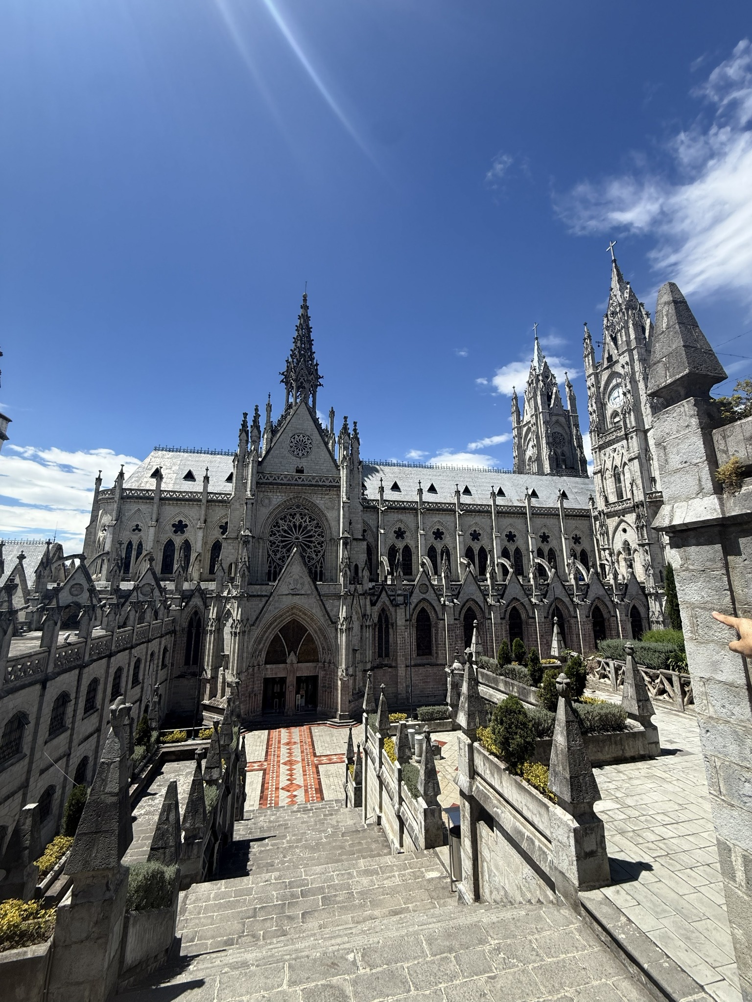
The Plaza Grande has the standard Spanish-colonial arrangement: presidential palace on one side (Carondelet), cathedral on another, archbishop’s palace, municipal hall. Walk a few blocks and you reach the Basílica del Voto Nacional — a neo-Gothic pile begun in 1892 whose gargoyles are local fauna: armadillos, iguanas, condors, where Europe would have had devils.
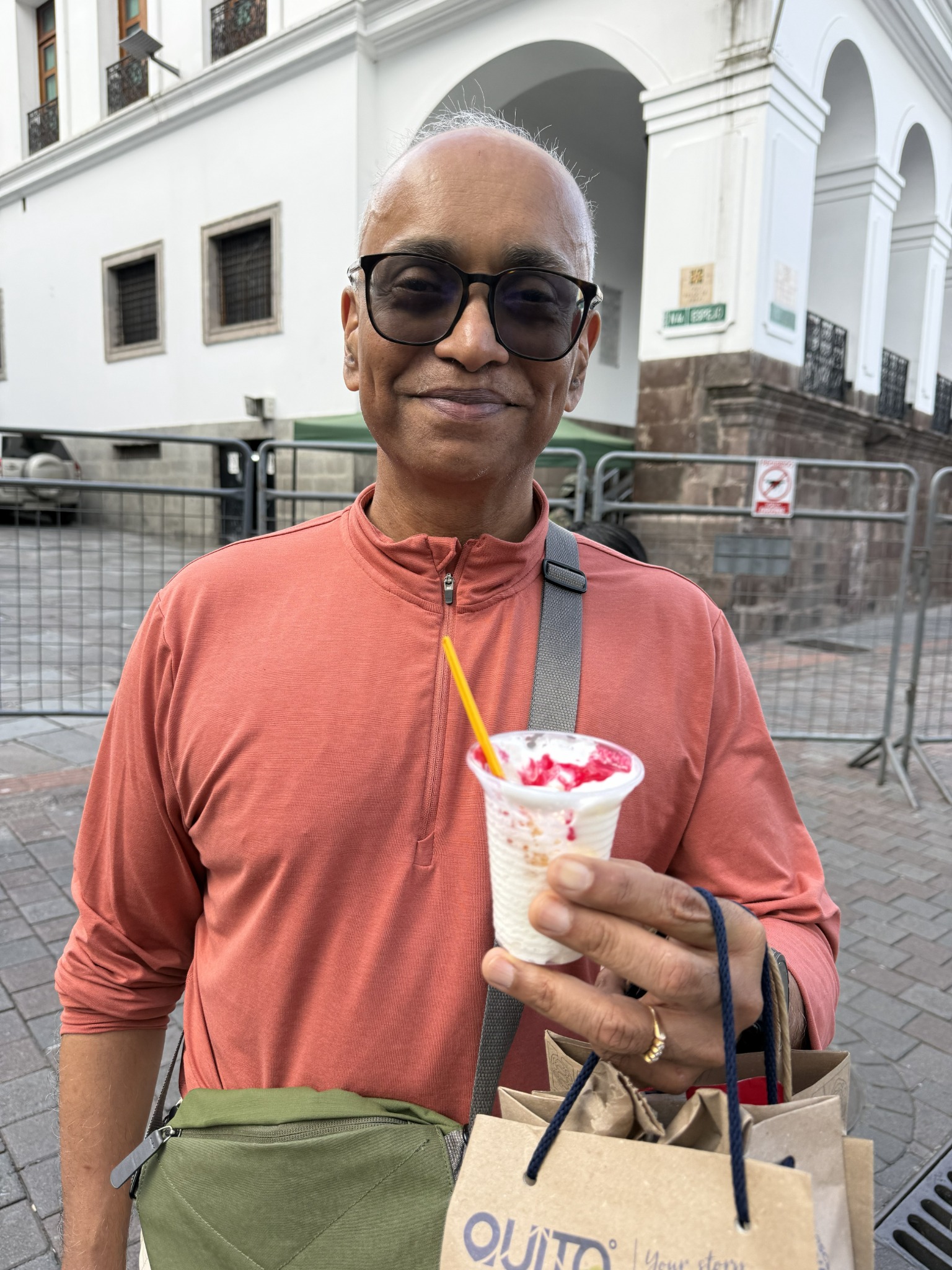
In the old town I had ponche — Quito’s traditional cold dessert, whipped egg whites topped with a raspberry sauce. Not what most non-Latin-Americans expect from that word.
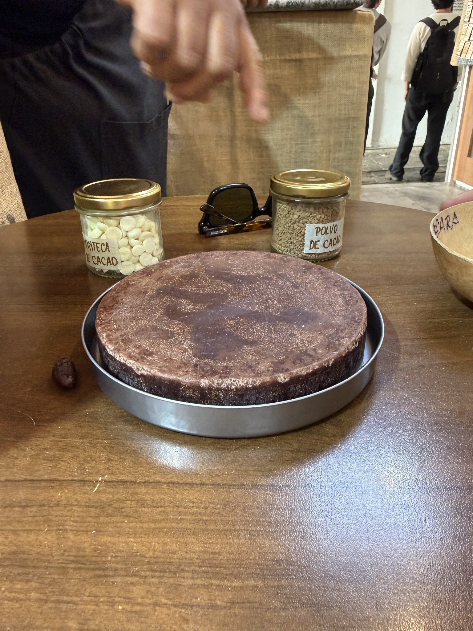
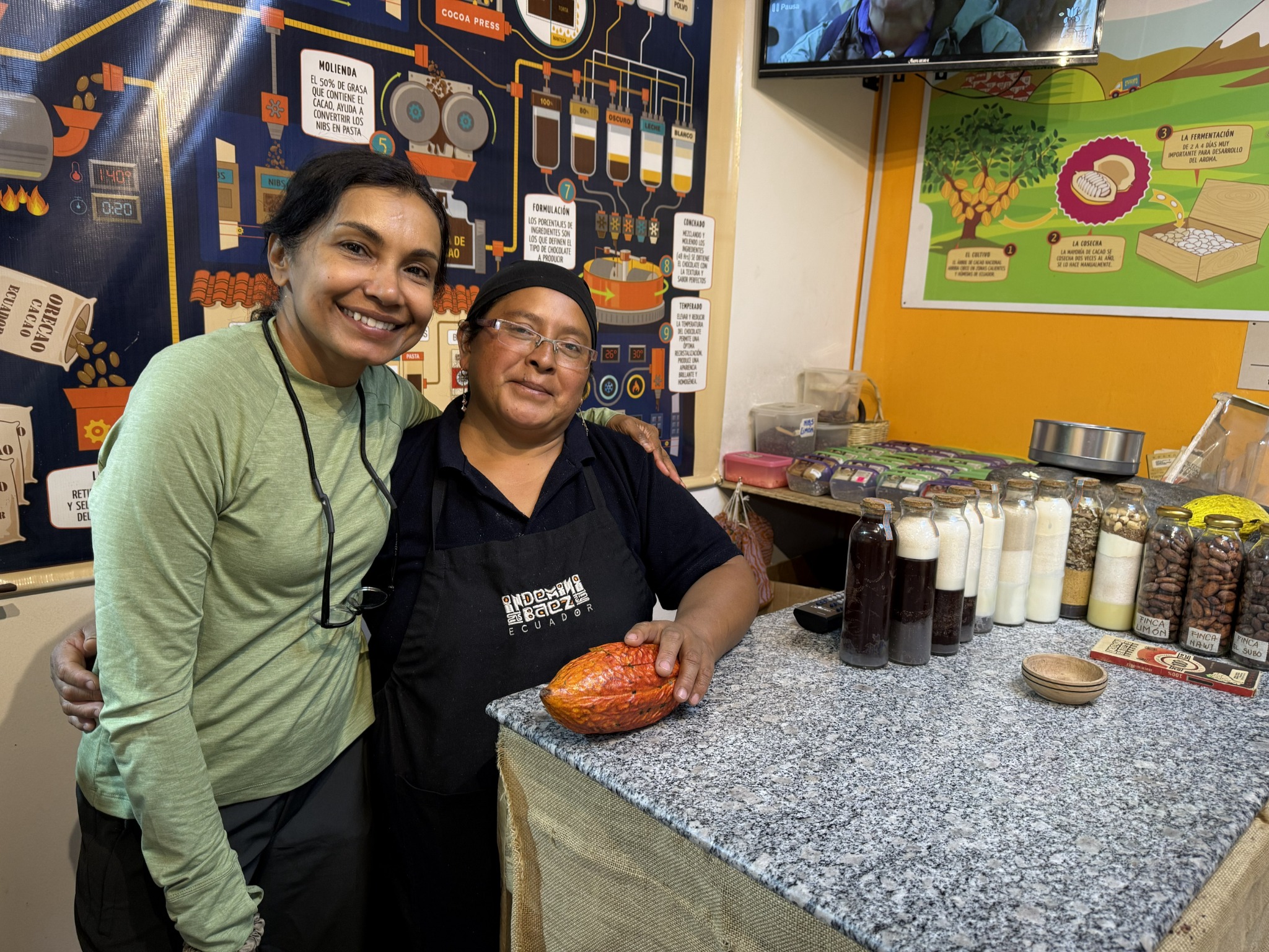
Ecuador grows what’s called Arriba Nacional cacao — one of the world’s premier fine-flavor varieties, prized for its floral aroma. We watched the chocolatier walk through the steps: harvest, ferment, dry, roast, winnow, grind into pasta, separate into butter (manteca) and powder (polvo), then formulate.
Ecuador, in hindsight, has much more personality than Peru — small country, but it really has one.
II. The Galápagos: Where Geology Outpaces Biology
The Galápagos sit on the equator, about 600 miles west of mainland Ecuador. The flight from Quito is a two-hour Avianca run — the Colombian flag carrier, much reduced after a 2020 bankruptcy. The arrival airport, on the small flat island of Baltra, was rebuilt in 2012 to run on solar and wind power, with rainwater capture and seawater desalination for the rest. They don’t use water in the urinals.
Baltra hosted the American “Beta Base” during the Second World War, set up in 1942 to guard the southern approaches to the Panama Canal. A side-effect that’s only now being reversed: the base extirpated Baltra’s native land iguanas (Conolophus subcristatus), which were reintroduced from neighboring North Seymour starting in the 1990s.
Santa Cruz and the tortoises
From Baltra, a small automated ferry crosses the Itabaca Channel to Santa Cruz — the most populated island, around 30,000 people. The biggest island in the archipelago is Isabela, seahorse-shaped, formed by six coalescing shield volcanoes, with about 2,200 people in Puerto Villamil and vast tracts of uninhabited interior. Our guide Daniel said his grandfather had moved there from the mainland in the 1950s and essentially got the land for free — and built everything (house, food, water) himself.
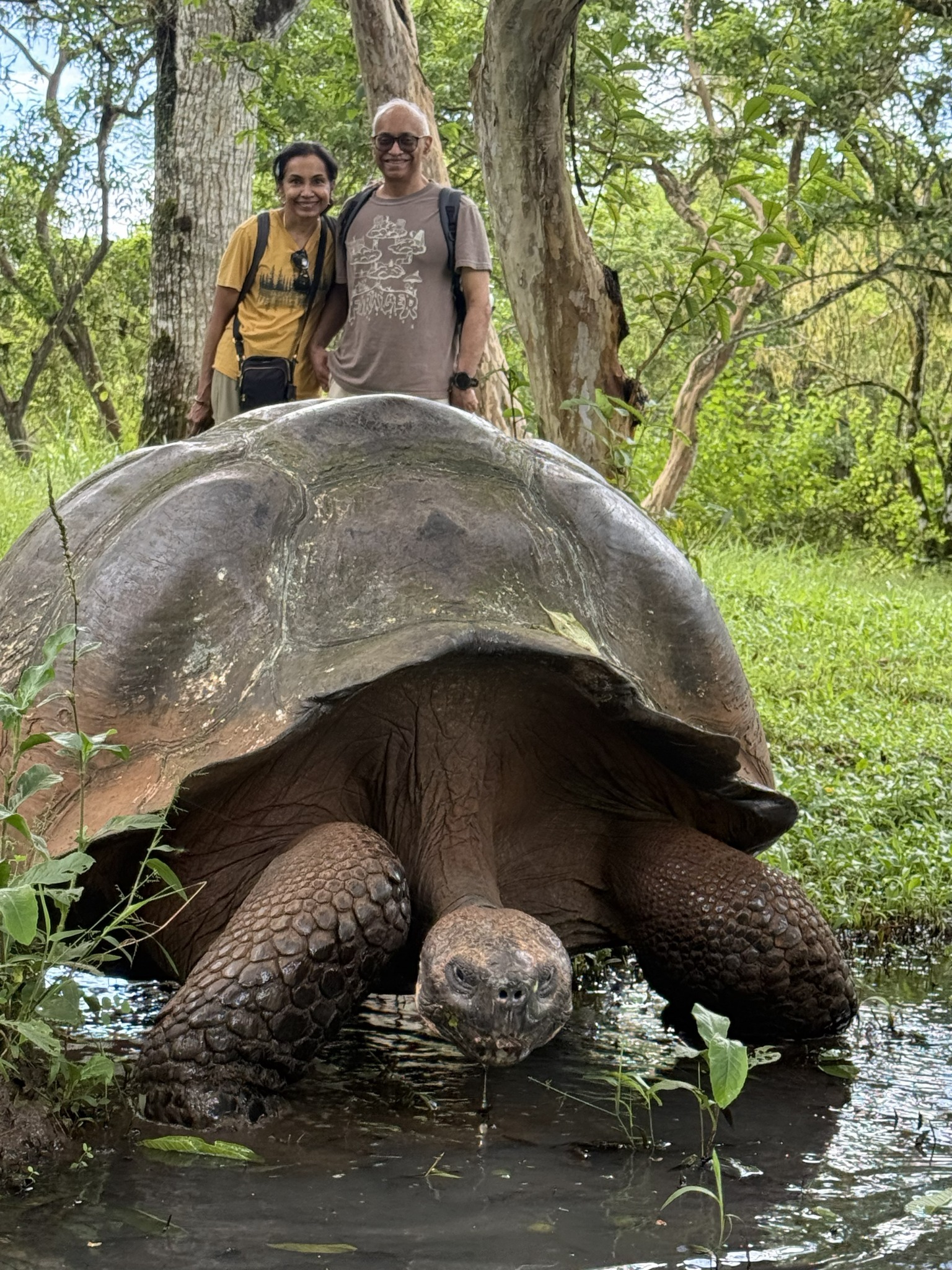
Santa Cruz has tortoises — real, Chelonoidis tortoises, supposedly between 100 and 200 years old, which is well within the species’ lifespan. They are quite unafraid of you.
The Charles Darwin Research Station has run since 1964. It hatches and raises baby tortoises to about five years before releasing them. Historically, the tortoises were devastated by whalers and buccaneers — they could survive a year in a ship’s hold without food or water, a grim convenience — and by introduced rats, pigs, and goats. Birds and most other native species are less threatened.
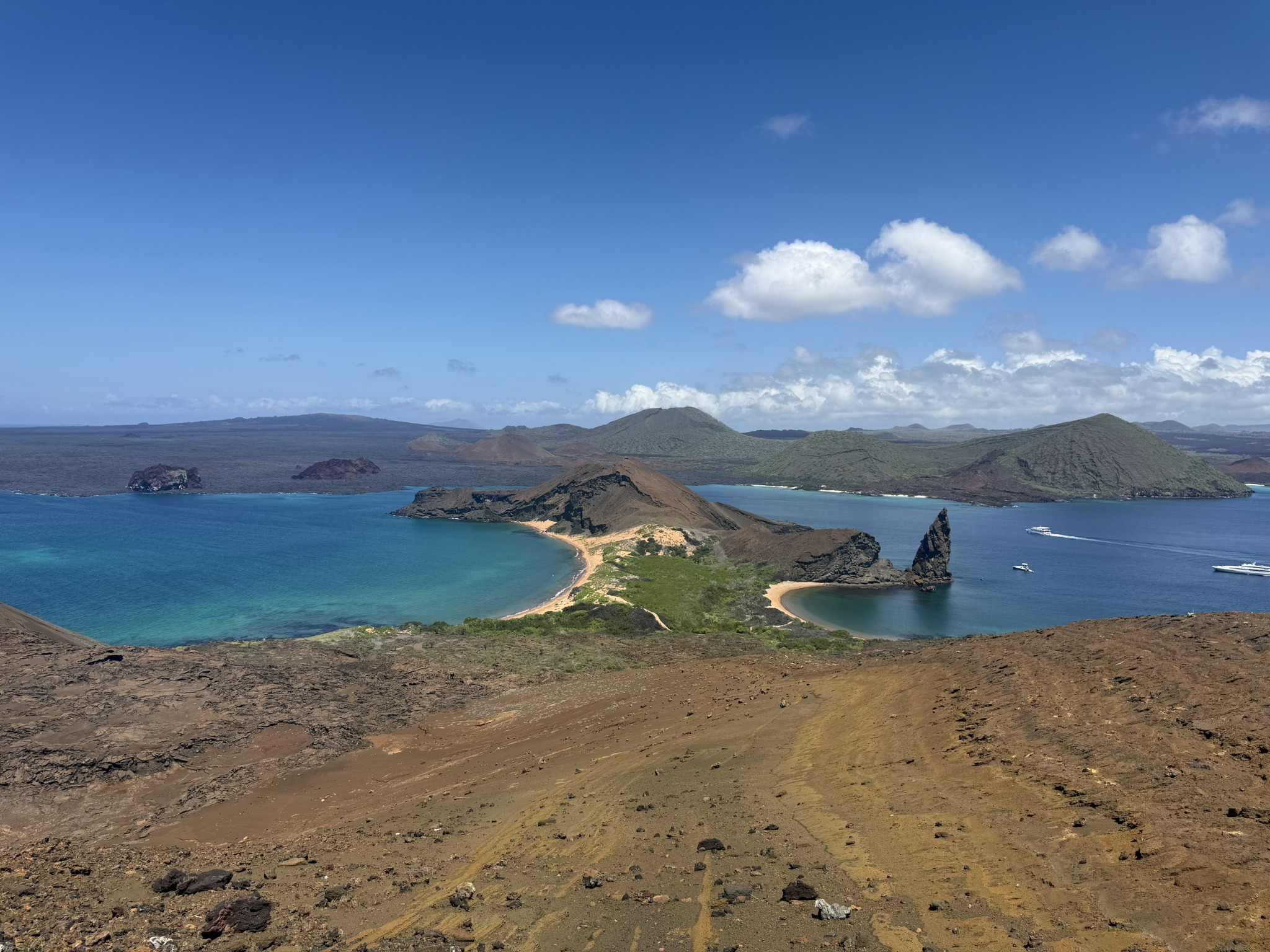
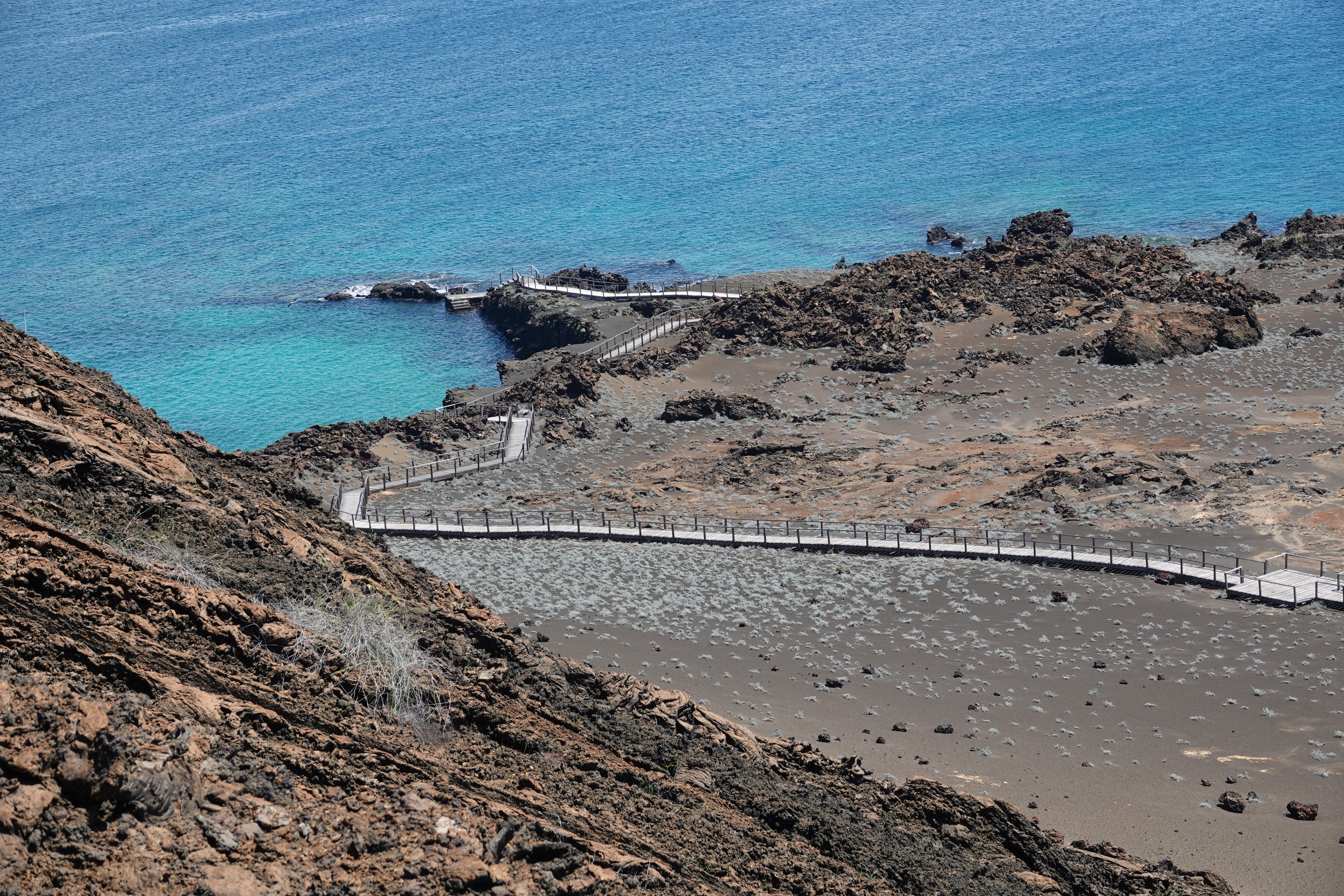
Bartolomé and Santiago
At 6:00 AM at the Puerto Ayora bus stop, with the naturalist guide Pepe Villalba, we met a British carnivorous-plant specialist named Stuart McPherson who runs Redfern Natural History Productions — he was furiously writing notes for what would presumably become another Nepenthes or Sarracenia monograph. His tour company operates from Svalbard to Ethiopia to the Falklands.
The Beagle officers haunt the place names here: Sullivan Bay after Lieutenant Bartholomew James Sulivan, Bartolomé Island after his colleague David Ewen Bartholomew. (Santiago is the older Spanish name, anglicized to “James Island” by Darwin’s contemporaries.) HMS Beagle was anchored here for several weeks while Darwin and others mapped the area — Darwin himself, formally, was the “gentleman companion to the captain.”
Bartolomé is geologically young — built by lava flow over the last few hundred thousand years rather than just a few hundred, though some surface flows on neighboring Santiago are only a couple of centuries old. The walk goes from sea level to the summit at about 114 m (374 ft). Lava lizards (Microlophus albemarlensis), blue-footed and Nazca boobies, a magnificent frigatebird (Fregata magnificens) with a roughly two-meter wingspan. Frigatebirds can’t take off from water, so they live an aerial life and pirate fish from other birds in mid-air — kleptoparasitism, formally. The ash underfoot turns out to be not just black: there are iron-oxide reds, white volcanic rock, and scoria — pumice’s heavier vesicular cousin, formed from more mafic, less gassy magma.
Snorkeling off Santiago, I saw a shark and panicked for a moment until I worked out it was a whitetip reef shark — uninterested in humans. Then a green sea turtle (Chelonia mydas), surgeonfish, parrotfish, the endemic Galápagos sergeant, against a coral reef that’s not as rich as the Maldives but is genuinely beautiful in its own right.
The view down from Bartolomeo’s top.
San Cristóbal
San Cristóbal is the easternmost main island and the provincial capital — Puerto Baquerizo Moreno is its modest seat of government. It has sea lions — the endemic Zalophus wollebaeki, a smaller cousin of the California sea lion — and a great deal of vocalizing, especially the territorial males. They block paths. They occasionally lunge.
The frigatebird hill is called La Tijeretas — tijereta is Spanish for “scissor,” after the fork-tailed silhouette. A steep walk up, and a small cove at the bottom where I should have brought my snorkeling gear.
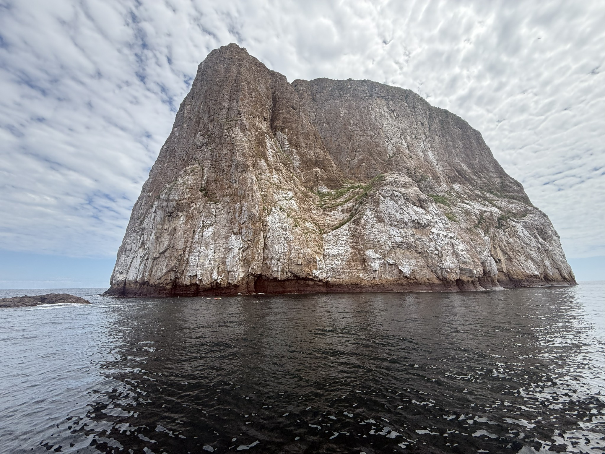
The day at Kicker Rock — locally León Dormido, “sleeping lion,” after its profile from a distance — was the trip’s snorkeling highlight. The rock is the eroded remnant of a tuff cone, sliced almost in two by a narrow channel, and rises about 150 m straight out of the water. We saw scalloped hammerheads (Sphyrna lewini, often in schools through this channel), Galápagos sharks, sea turtles. You can literally feel the boundary between Humboldt-cooled water from the south and the warmer surface layer — the currents push you toward the rock and then pull you away.
III. Peru: Stone, Water, and What 575 Years of Earthquakes Will Do to a Wall
Lima
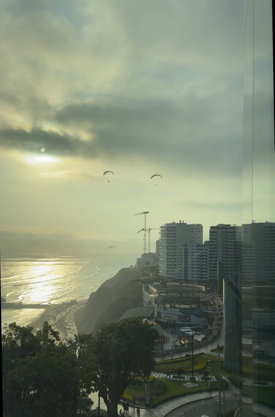
Lima is a city perched on cliffs — the Costa Verde, the lift band of which paragliders ride along the Miraflores coast like buoys in a slow current. It looks a bit like Cape Town in that respect, though Lima sits under a near-permanent gray marine layer (the garúa) for half the year, courtesy of the cold Humboldt Current offshore.
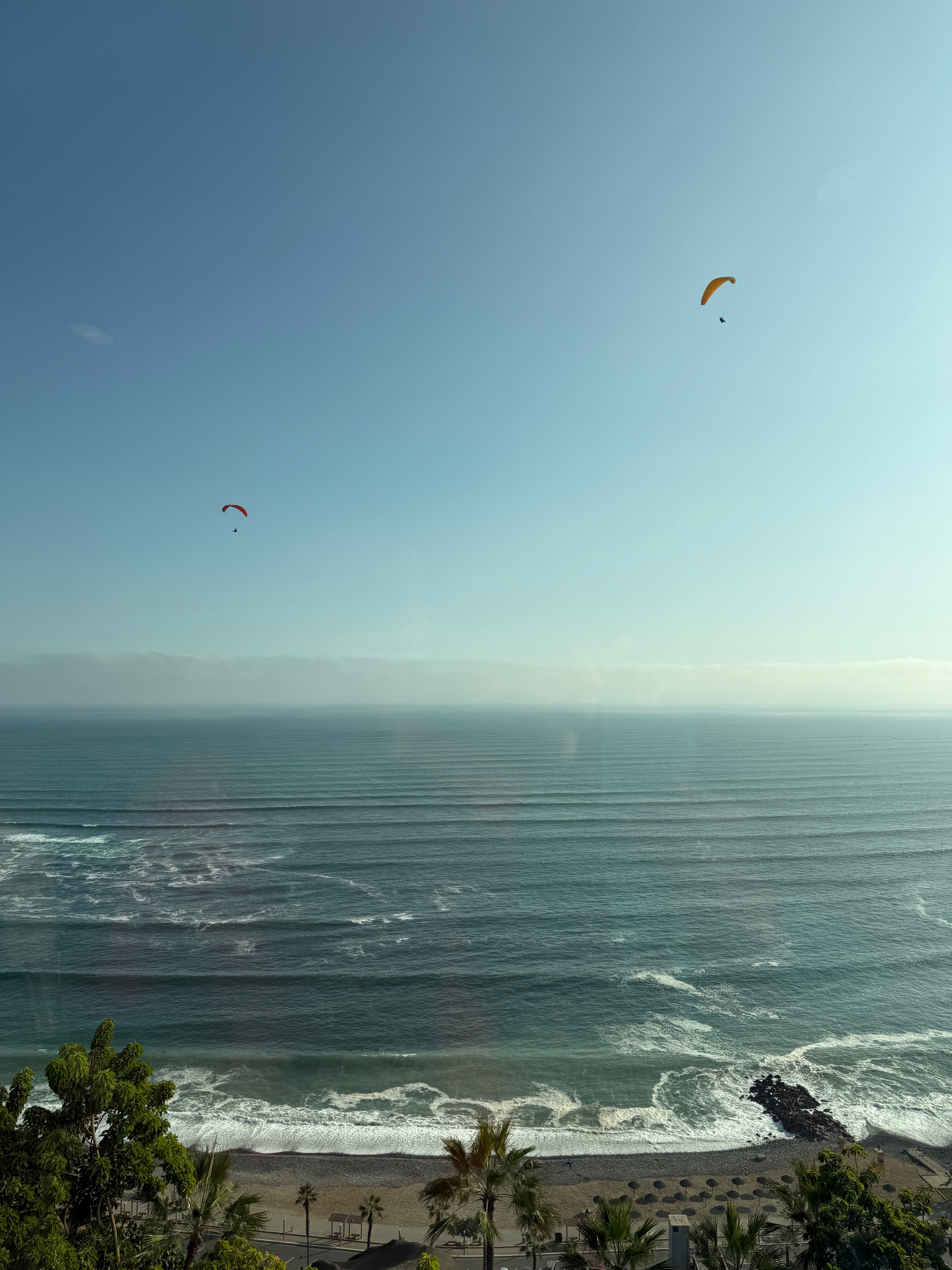
A sunset view, with the garúa (Spanish word meaning drizzle or mist) visible over the coast.
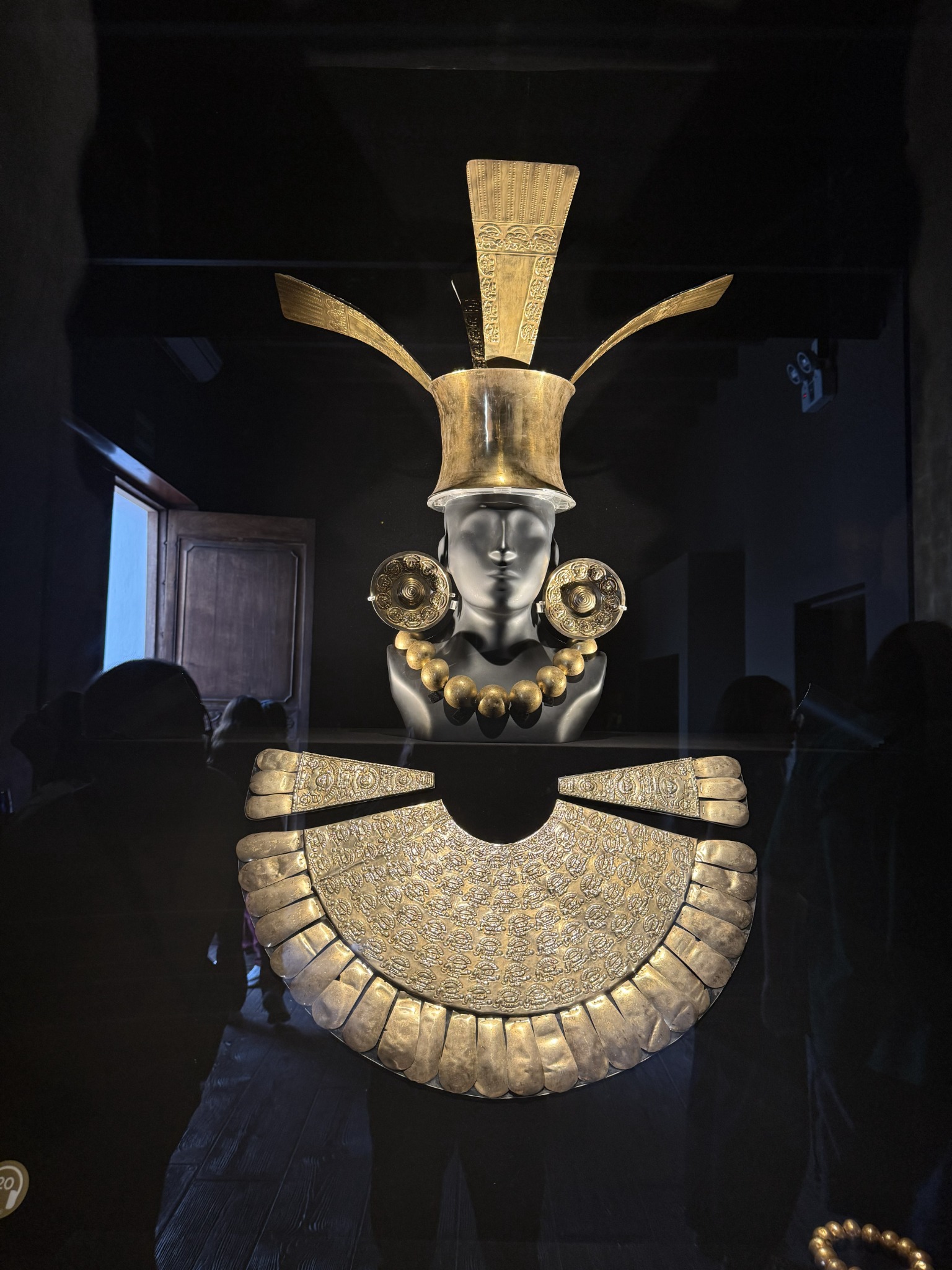
Lima sits over older Lima. Huaca Pucllana, a great adobe-and-clay stepped pyramid built by the Lima culture between roughly 200 and 700 CE, was used as a rubbish dump in modern times before residents rescued it from the 1980s onward. The Larco Museum, established by Rafael Larco Hoyle in 1926 in a colonial mansion built on top of (you guessed it) another pre-Columbian pyramid, holds an extraordinary collection of pots and clay portraits. The earliest civilization on the Peruvian coast — Caral-Supe, in the Supe Valley north of Lima — isn’t represented, because the site wasn’t excavated and dated until the late 1990s, long after the museum was set up.
Downtown, near the Presidential Palace where Pizarro lived, the Casa de Aliaga has been continuously occupied by the same family since 1535. That makes it the oldest such house in the Americas. Dinner that night was at Astrid y Gastón — Gastón Acurio’s flagship, which more or less single-handedly relaunched Peruvian cuisine onto the world stage in the 2000s. Astrid happened to be there and came out to say hello.
Peruvian ponche — different drink, same name as the Quito dessert — is made with egg whites and fermented barley. Mazamorra morada, the deep-purple corn pudding from maíz morado. Picarones, ringed sweet-potato-and-squash fritters drizzled with chancaca syrup. Turrón de Doña Pepa, layered and treacly, dates to colonial Lima.
Cusco and the Sacred Valley
The LATAM flight to Cusco lands at 3,310 m (10,860 ft) — Alejandro Velasco Astete airport. From there, the Sacred Valley.
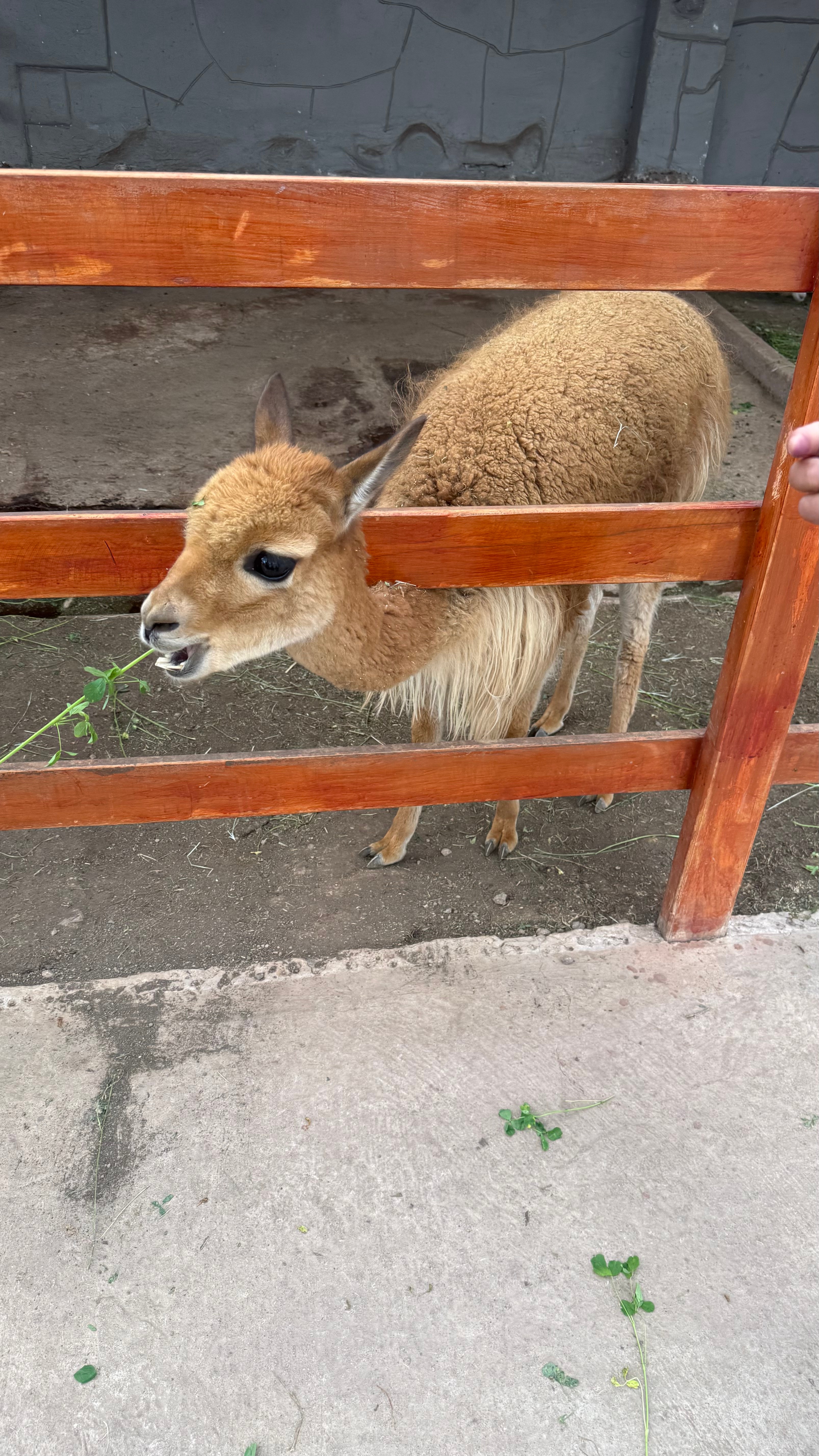
The South American camelid family has four members. Vicuña and guanaco are wild; llama and alpaca are their respective domesticated descendants, separated something like 5,000–6,000 years ago. Llamas spit a partly-regurgitated mix of grass and stomach acid when annoyed. Vicuñas, only semi-managed, are the wild and savage cousin — and their fleece is among the most expensive natural fibers in the world by weight. Guinea pigs are cuy, an Andean food staple going back millennia; they were domesticated for food long before they ever became Western pets.
Chicha morada — a non-alcoholic purple corn drink made from boiled maíz morado with pineapple, cinnamon, and clove, sweetened and chilled. A different drink, again same name family, from fermented chicha de jora.
How the Inca built things
Moray is three sets of concentric circular terraces sunk into natural depressions, with temperature differences of as much as 15 °C between the top and bottom rings. The standard interpretation — plausible but not proven — is that it was an agricultural experimentation site, each terrace mimicking a different microclimate. The salt pools at Maras are a separate thing entirely: pre-Inca, fed by a single hypersaline spring that emerges from the mountainside, channeled into thousands of evaporation pans held cooperatively by local families.
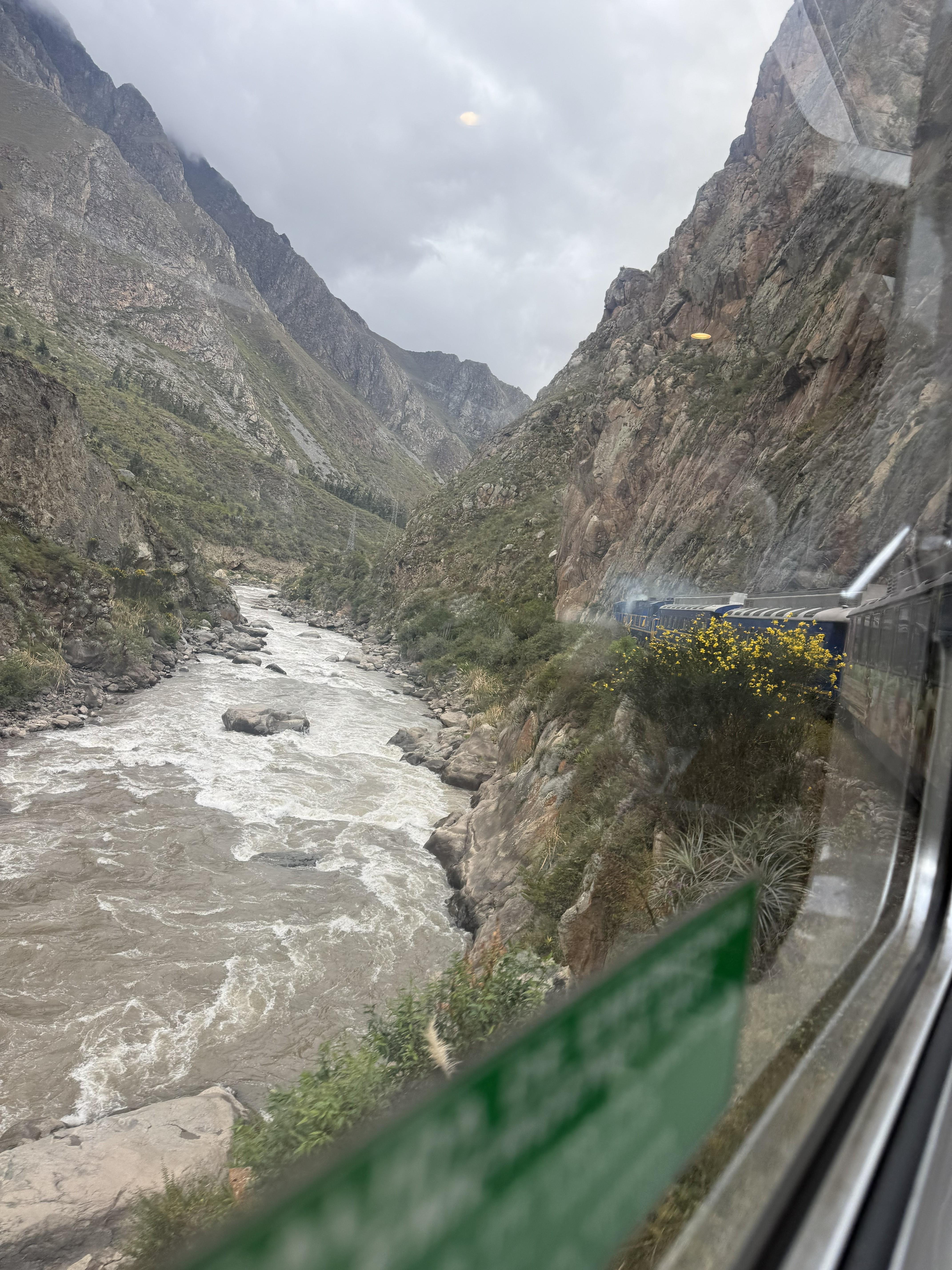
The retaining walls along the trail above the Urubamba River are still standing after 500 years. They use some mortar, but not much. What they have instead is geometry: trapezoidal courses, slightly inward-leaning faces, and the trick of treating the natural rock face as the lower part of the wall and only building masonry where the bedrock falls short.
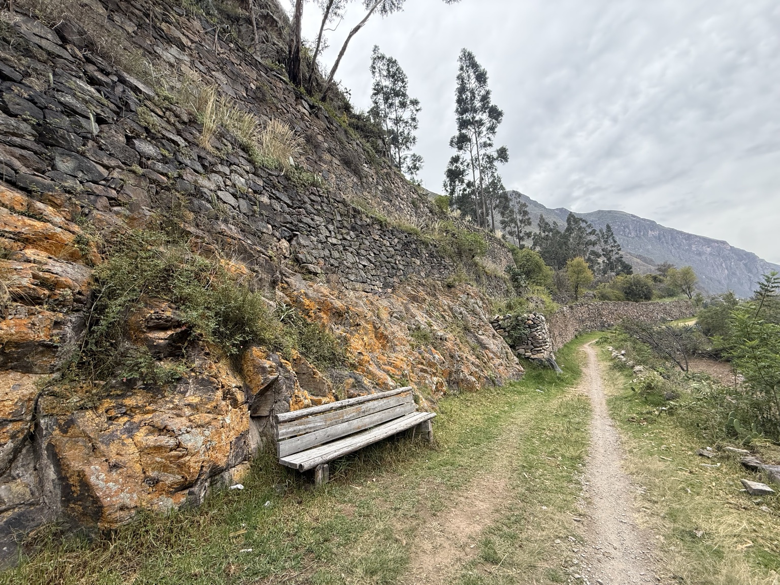
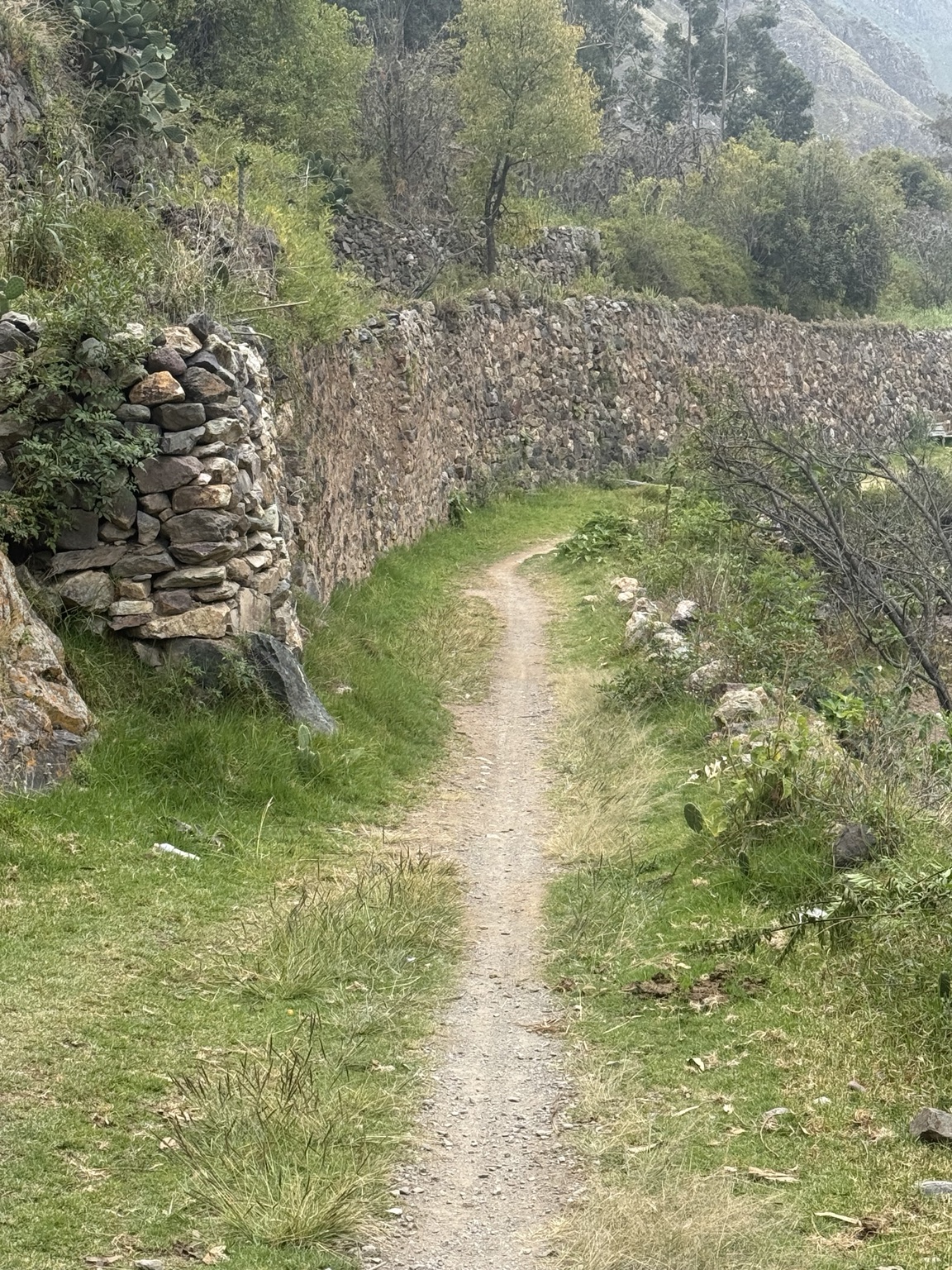
These are a tiny fragment of the Qhapaq Ñan — the imperial road and infrastructure network whose total length is variously estimated at 30,000 to 40,000 km, of which the walls and channels are only one component. The water management is what stays with you: water sent from the top of the valley to the bottom through controlled stone cascades that dissipate energy before each drop, so the flow neither erodes the walls nor builds pressure behind them. Pressure relief by design, not accident.
The Inca never developed the true keystone arch. That’s one of those quiet asymmetries between Eurasian and American architecture. Their solution — the trapezoidal opening — works. The arches still stand.
Machu Picchu
The name is almost certainly not what the Inca called it. No one knows the original name; Patallaqta turns up as one candidate in colonial-era documents. Machu Picchu means “old peak” in Quechua and was the local name for the mountain, which Hiram Bingham applied to the ruins after his 1911 rediscovery.
The site is a royal estate, not a city — most likely built by Pachacuti, the ninth Sapa Inca, around 1450. Construction estimates run to roughly 80–90 years. It was abandoned within about a century of completion, around the time of the Spanish conquest, and wasn’t fully finished at the end. The best-fitted ashlar masonry, the kind where a knife can’t slip between the stones, is reserved for the temples and royal quarters; ordinary buildings use rougher cyclopean work.
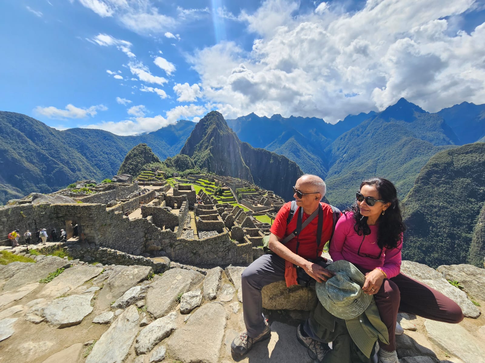
The vertical mountains around the citadel — the Vilcanota range, the upthrust eastern edge of the Andes — are arguably more spectacular than the ruins themselves. They drop away into the upper Amazon basin just behind the site.
A small fact that does not get enough attention: the whole complex is built on a fault line. Some structures have visibly shifted; the Intihuatana (the “hitching post of the sun,” at the top of a small pyramid) is no longer accessible because parts of the supporting structure aren’t stable, and is supported in places by wooden braces and metal rods. Quite interesting to see, over roughly 575 years since construction began, what’s happened to a building set on moving ground.
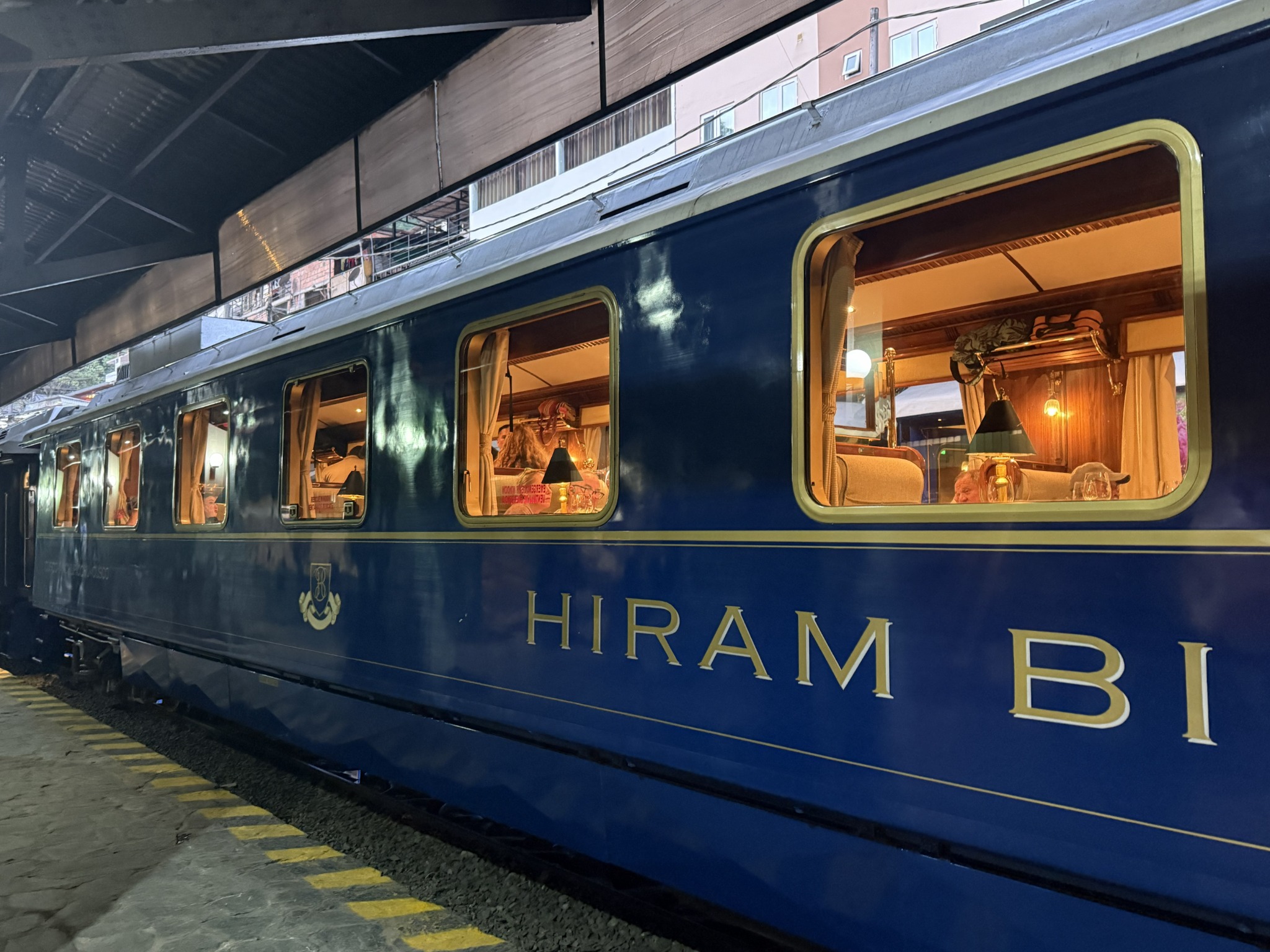
The Hiram Bingham train back to Cusco takes about three hours along a 914 mm (3 ft) narrow-gauge line — tight curves and steep grades make narrow track sensible here.
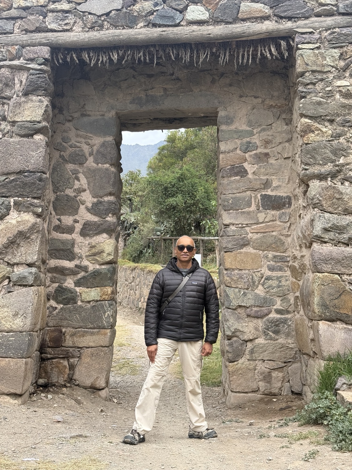
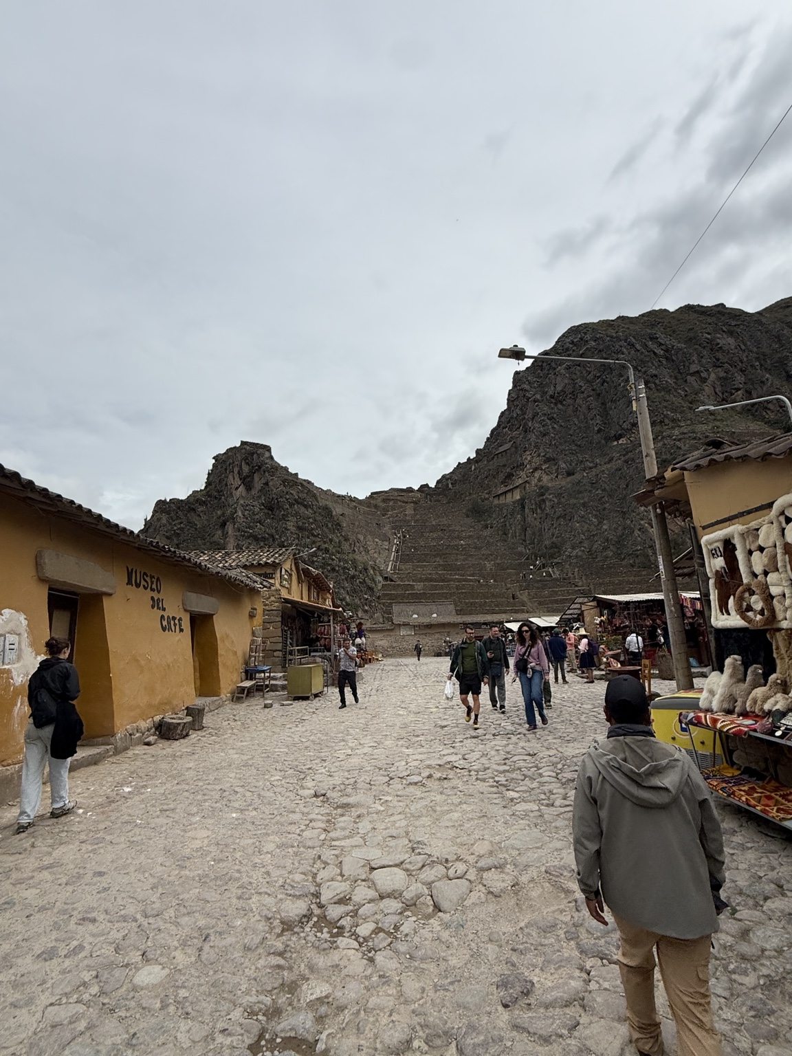
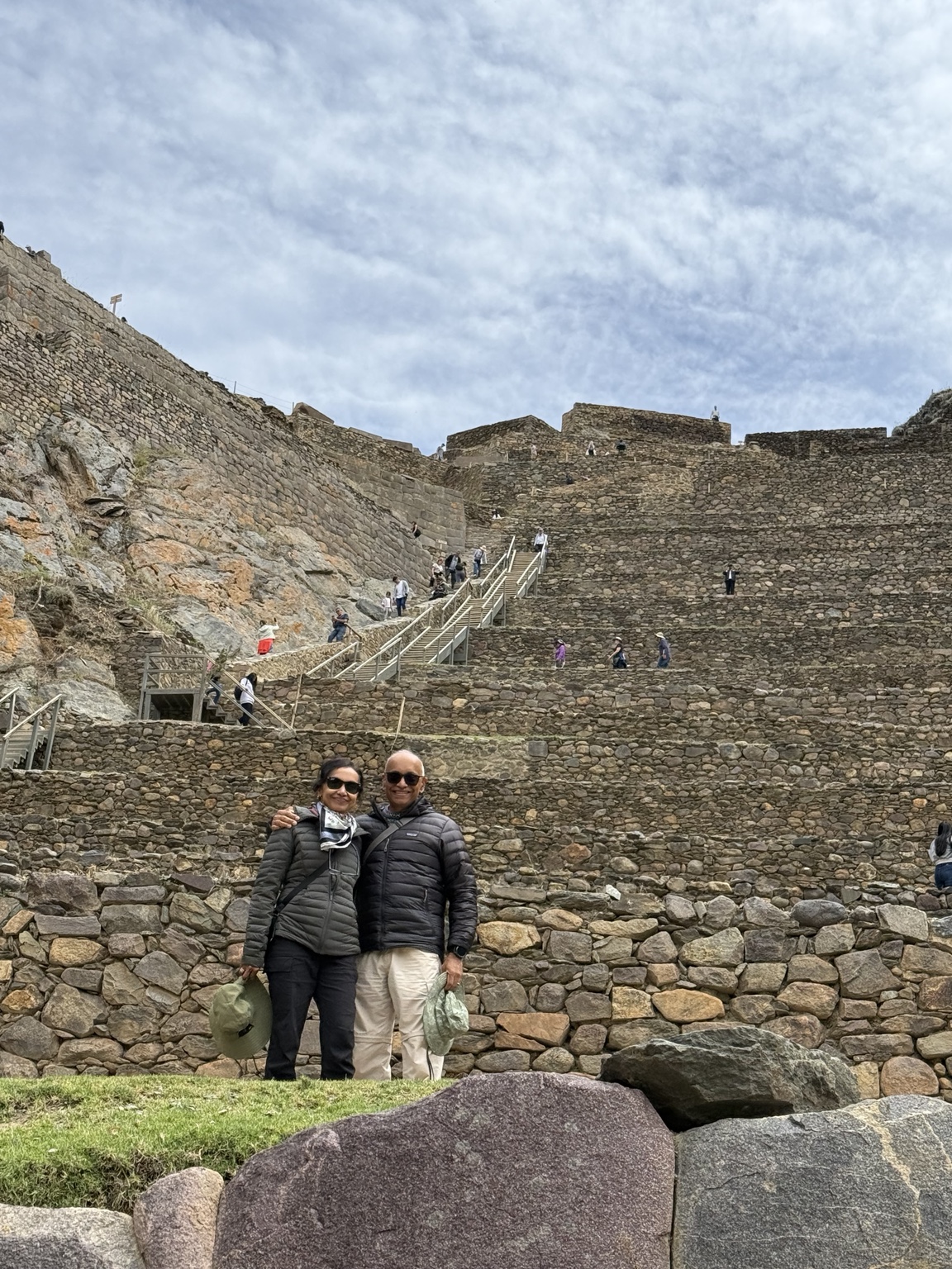
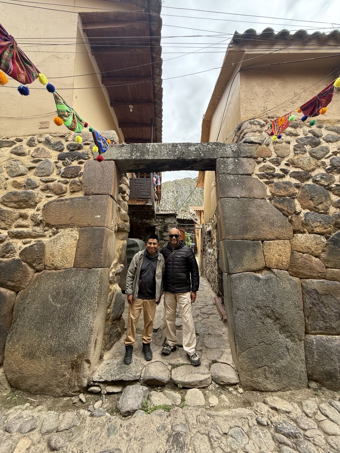
Ollantaytambo
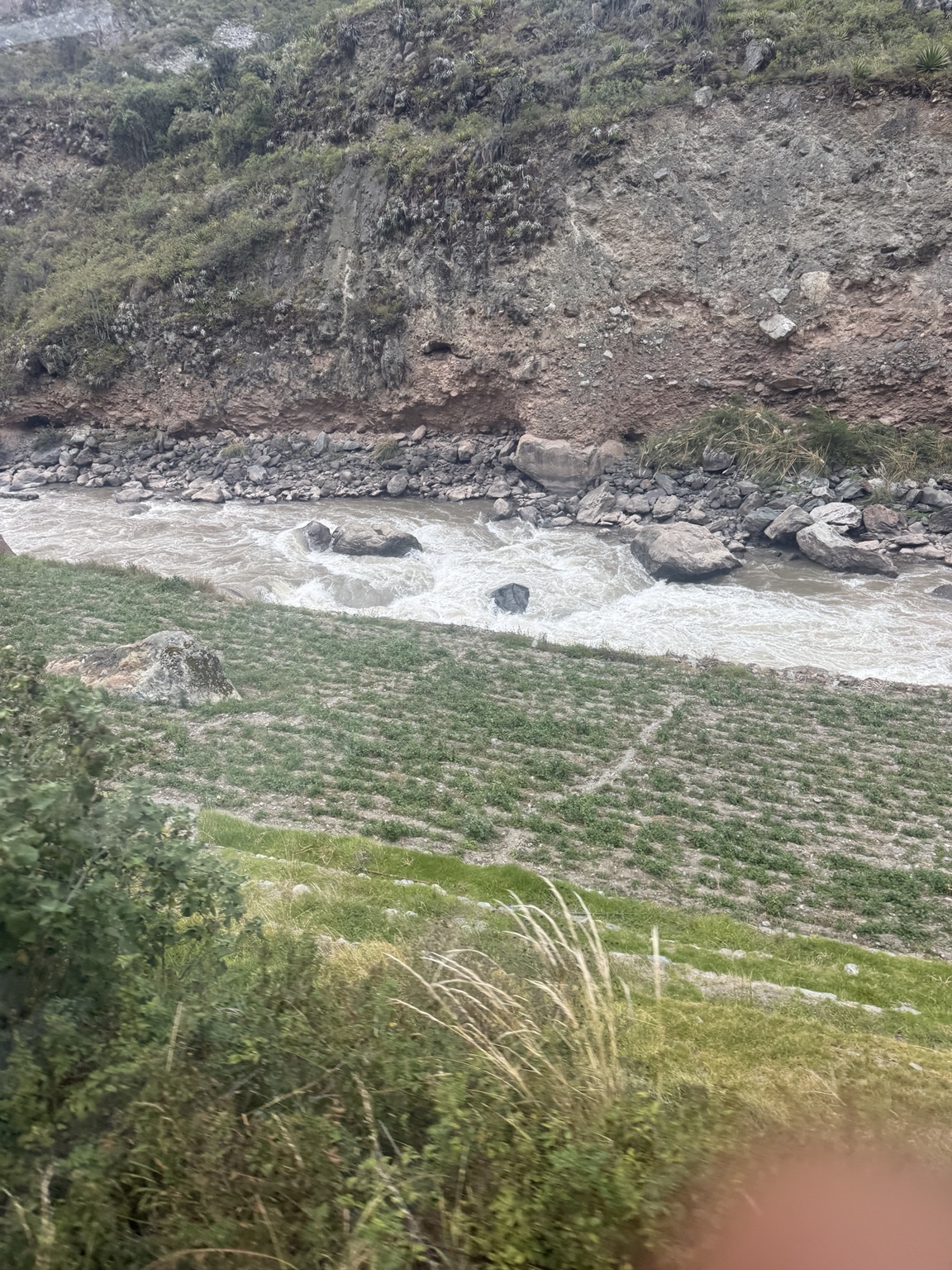
Ollantaytambo was being built as a major ceremonial and administrative center when the Spanish arrived. It was never completed — though not before Manco Inca Yupanqui used it as a base in 1537 to inflict one of the very few field defeats the Spanish ever suffered in the Andes, by diverting the Urubamba river (shown below) to flood Hernando Pizarro’s cavalry. The horses bogged down; the Spanish withdrew to Cusco.
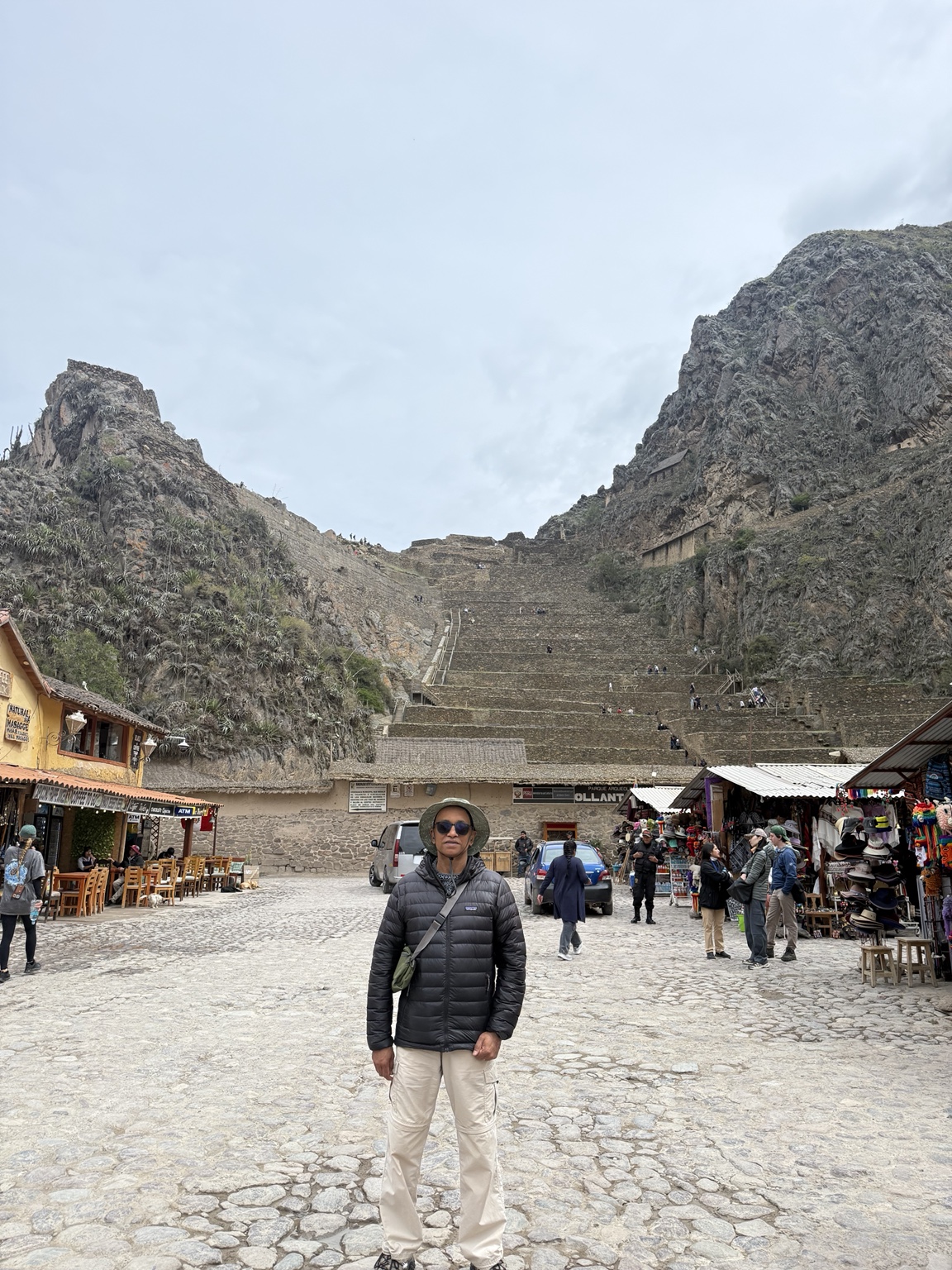
At the base of the enormous steps of Ollantaytambo.
The structure was apparently built by rolling rocks up a ramp on the far side of the valley and then pushing them down from the top of this side to build the fountain-and-terrace complex from the bottom upward. The ramps are still visible on the far slope, six kilometers from the quarry.
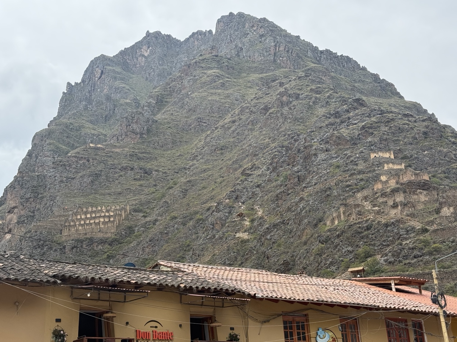
The mountain across the valley from the fortress is Pinkuylluna. The small structures high up its flanks are Inca storehouses (qollqas) — placed there deliberately to take advantage of cold mountain air for grain preservation. Refrigeration without refrigerant.
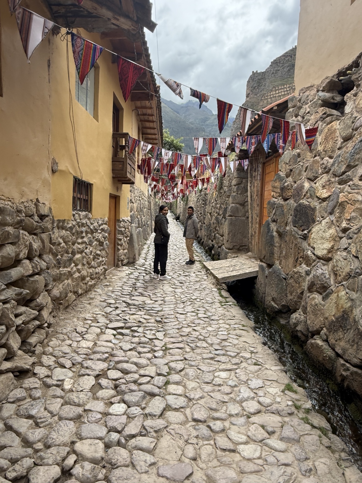
The town itself still has the Inca street grid, with the original water channels running beside the cobbles.
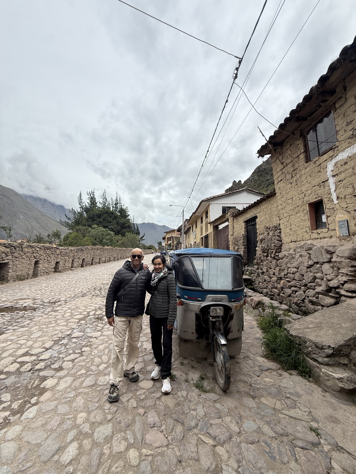
Bajaj autos in unlikely places
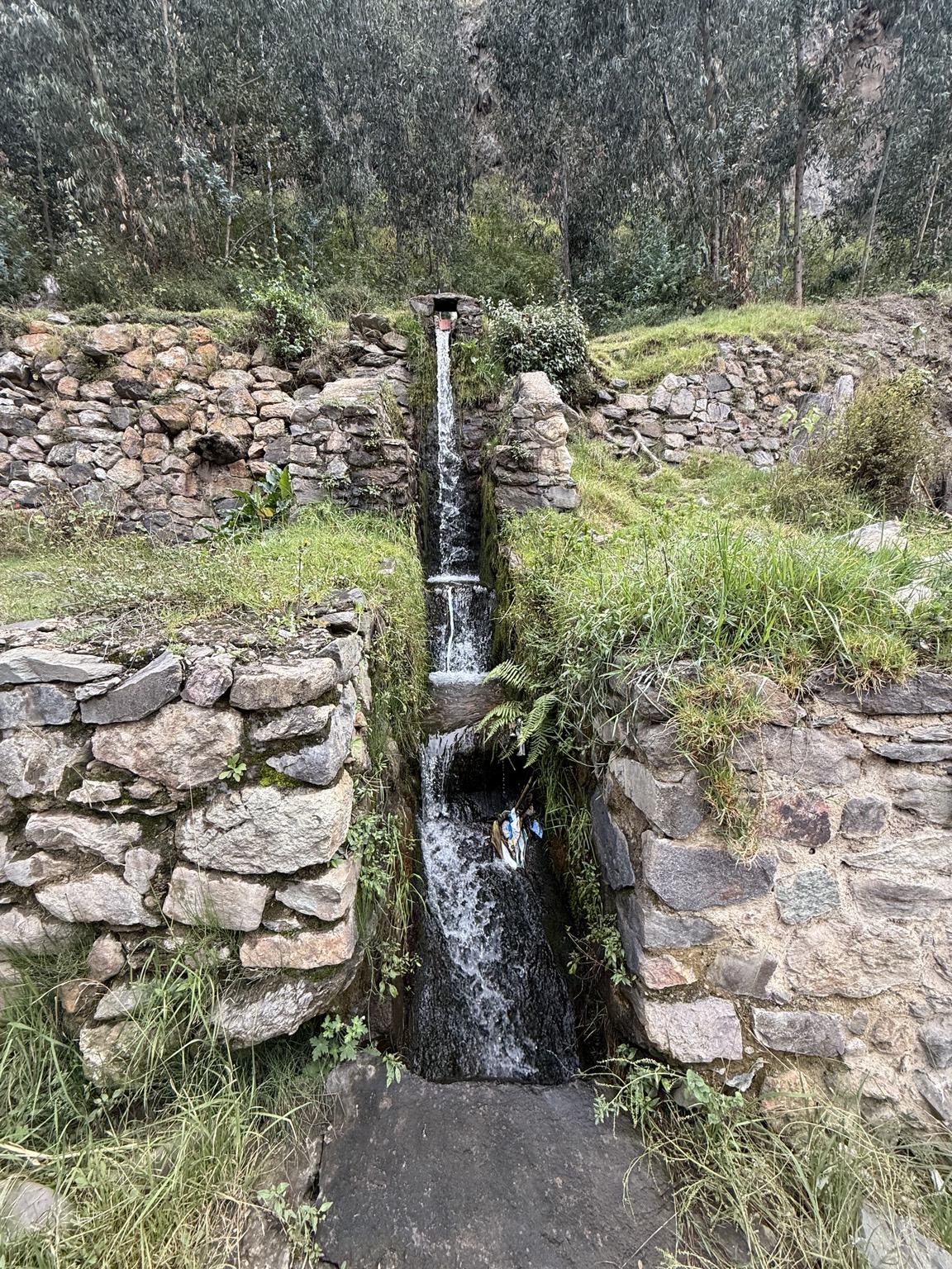
A Sacred Valley water cascade — gravity-fed, baffled at intervals to dissipate energy before the next drop. Same principle, different scale.
Pachamanca cooking — heated stones placed in a pit, food laid on top, sealed with leaves and earth — is essentially an earth oven. Conceptually similar to a tandoor, with rocks instead of clay walls, the output tastes the same and is as healthy. Probably also how the Mohenjo-daro civilization cooked, except they had baked and sun-dried mud bricks rather than rocks. The Indus Valley standardized brick dimensions on a 1:2:4 ratio as early as the third millennium BCE, a kind of engineering modernity the Inca never quite matched.
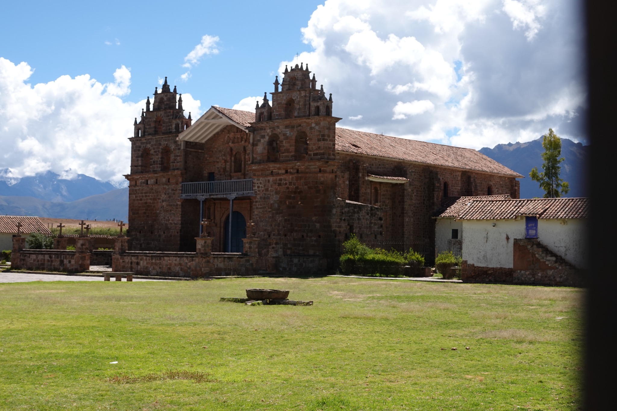
A Spanish church built on and with the materials of, an Inca temple.
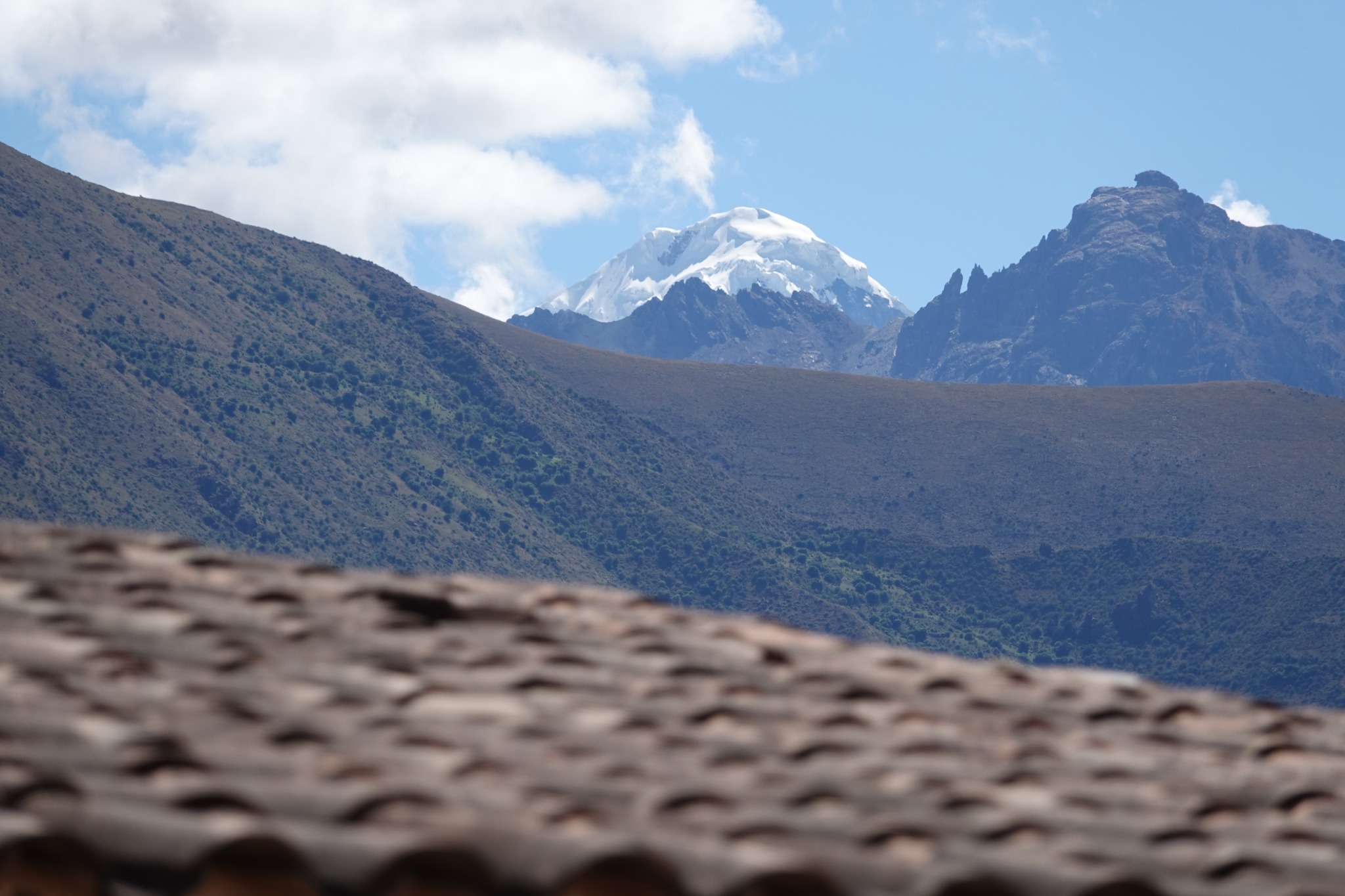
Mt. Chichon, snow-capped (so far)
The Urubamba river, again from the train.
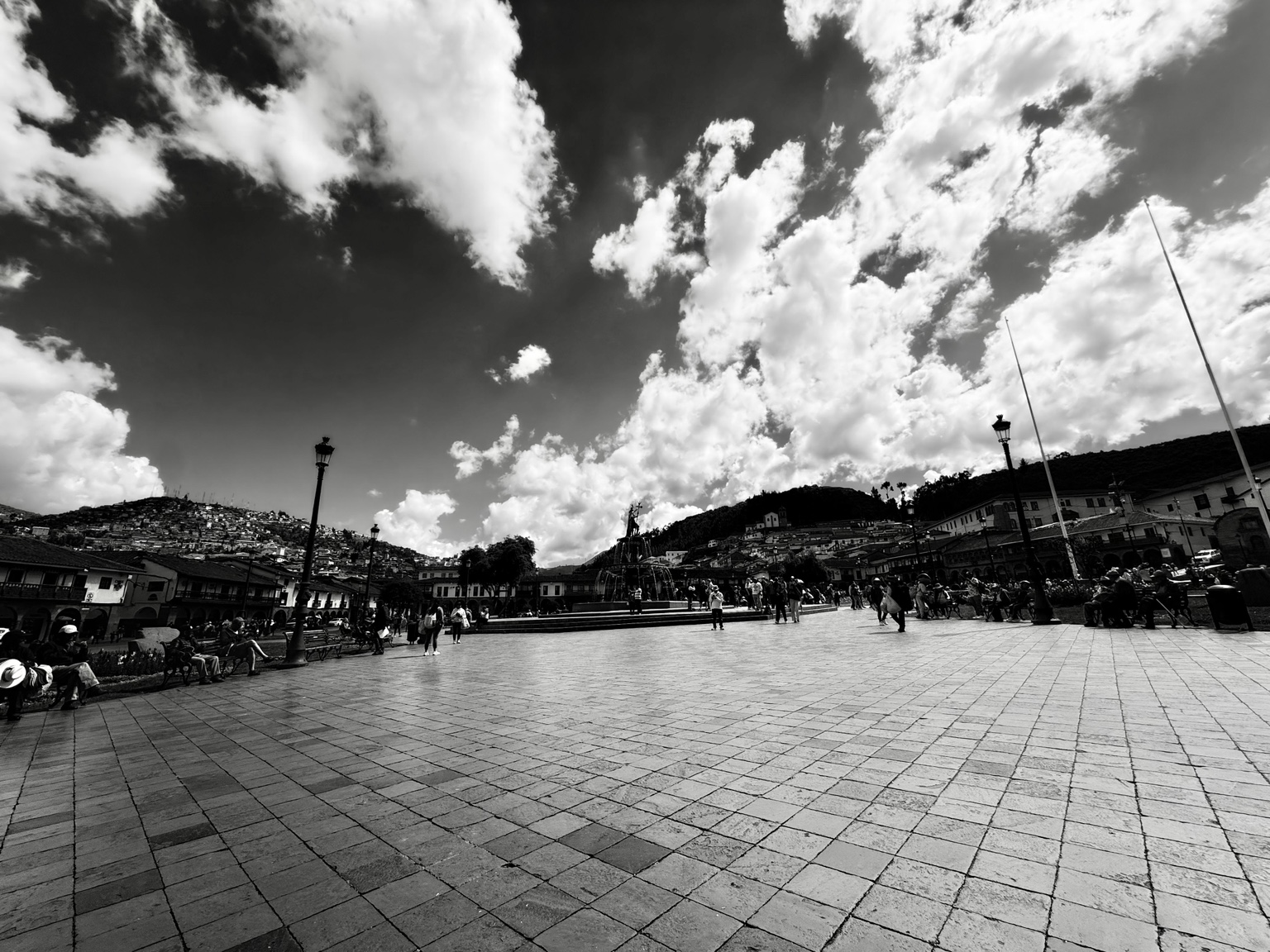
Cusco
We stayed at the Belmond Hotel Monasterio — the converted Seminario de San Antonio Abad, built in 1592 on the foundations of the Inca palace of Amaru Qhala. The grand tradition of the Spanish conquistadors was to destroy Inca religious and royal structures and build Catholic infrastructure on top of them. The famous monastery-on-sun-temple is actually a couple of blocks away: Santo Domingo, built on the Coricancha, which was the empire’s main solar shrine.
Sacsayhuamán above Cusco is the trip’s last act of stone. Often described as a fortress, its primary function was almost certainly ritual. The site sits on the head of the puma-shaped layout that Cusco was deliberately built into; the zigzag walls form the puma’s teeth. The largest stones weigh an estimated 100–200 tons, fitted without mortar to a tolerance that turns a knife away. How exactly they were moved and assembled is still a live question — the standard model is ramps, levers, and a great deal of organized labor.
Coda
What stays with me, weeks later, isn’t any single sight. It’s three patterns. First, that the same word — ponche, chicha — names different things in different valleys, and the differences are worth tasting. Second, that engineering without iron or wheels or arches still gets you 30,000+ km of road and water-channeled terraces that have outlasted everything the conquistadors built on top of them. Third, the architectural and engineering ability of the Incas was formidable – if they had had iron, they would have whipped the people that destroyed their empire. And fourth, that a fault-line citadel can stand for 575 years, leaning a little, propped a little, but standing. Which, honestly, is most of what you can ask of anything. Yes, they conducted child sacrifices, but is that any better than roasting people in fires? Cruelty is cruelty and should be universally left behind in our cultural evolution.

Leave a comment